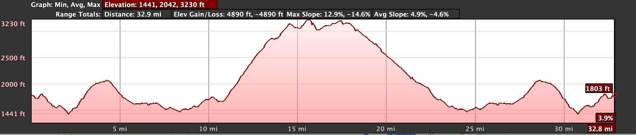
This loop will go through the town of Amandola and head towards the base of Monte Vettore. The road climbs to the foothills and loops back around. There are some nice quiet roads and beautiful views.
This ride is 33 miles with 3800 feet of climbing. Should take around 4 hours. We will stop in Amandola or Montemonaco for some snacks and capuccino.
Montemonaco
Click above or "More Options" below to open up the google route on an adjacent tab.
Click here to see map on google MyMaps. There you you can access a link to Google Earth on web. To access more features you can download the KMZ file. The file can be opened up with your native Google Earth application.
Note: Google Routes and Earth give different elevation gains.