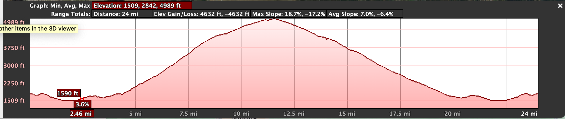
This loop goes up the backside of Sassotetto and descends down to Sarnano. The climb snakes up to Pian di Ragnolo. The road up is less traveled and narrow. Has some very steep pitches. Near the top it goes by the launch point for hand gliders. It is 25 miles long with 4100 feet of climbing. The road levels off above tree line and offers some nice views. It is finished off with a fun monster descent.
Hand Glider
Click above or "More Options" below to open up the google route on an adjacent tab.
Click here to see map on google MyMaps. There you you can access a link to Google Earth on web. To access more features you can download the KMZ file. The file can be opened up with your native Google Earth application.
Note: Google Routes and Earth give different elevation gains.